Creation of a digital map of Greece in 1940 (shapefile), for the requirements of the project ‘Database of German military and paramilitary units in Greece 1941-1944/45’
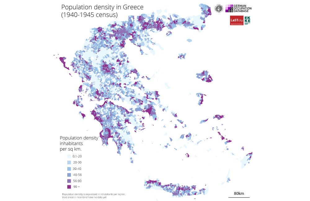
The aim of this project is the creation of a new cartographic baseline that would “remedy” a long-standing weakness of Greek census and demographic data, namely the inability to interlink them and map them accurately. In practice, this baseline could also support other research teams at EKKE working on this important period of the Greek history (1941–1945), enabling them to map their work correctly and, at the same time, to make their data comparable with contemporary data through straightforward spatial analysis procedures.
Duration: 2021
Funding: National Hellenic Research Foundation
Principal investigator: Stavros Spyrellis